November 13, 2016

Fall and Winter Rides to Khartoum Lake


Viewpoint looking over Lois Lake towards the high country.
Quad riding in the Powell River area isn't limited to summer. Every season has it's own pleasures.

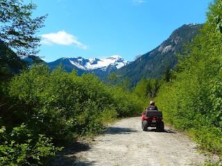
Fall and winter bring storms, but in between you can find some glorious days for riding. Most of the roads at lower elevations remain open and easy to ride since they are used by the logging companies.

Check on Western Forest Products' hotline at (604) 485-3100 or online to see if there are any closures or hauling activity scheduled. Or, you can check their most recent Operational Map pdf.


The bridge before you reach the Khartoum Forest Campground.
If you drive south of Powell River to Dixon Road, you enter a world of lakes and forests. Here's a link to the Recreation Sites and Trails map from the BC Ministry of Forestry. But be careful, they show you going the wrong way at the one-way slit at the south end of Lois Lake.

During the week, this area is used by loggers. But after hours and on weekends, their extensive road system is available for use by the public with care.


Roadside parking.
On one winter trip, we saw a few trucks, jeeps, and handful of other quads, but most of the time we had the roads and trails all to ourselves.

Dixon Road quickly turns into a well used and often potholed dirt road. So, we quickly selected a turnout large enough for our truck and trailer.

Don't select one at a bend in the road. Logging trucks carry long loads that can swing really wide.


Good signage along the way.
We headed up Goat Lake Main and transitioned to the Stillwater Main heading towards Khartoum Lake.

The view up Lois Lake to the snowy peaks was unbelievable. We hadn't been this way in almost a year. At that time, the devastating winter storms had washed the bridge away.

It was thankfully been replaced and so we can return to this unique spot.


The calm waters of Khartoum Lake.
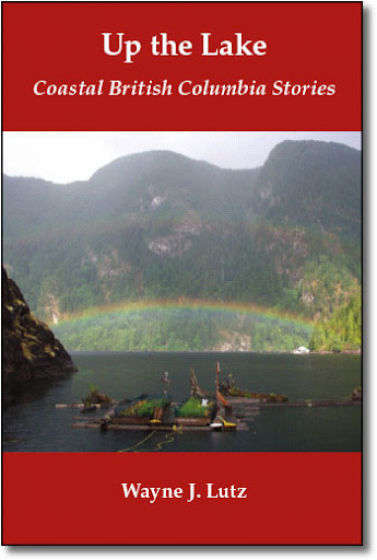
Khartoum Lake has a Forest Recreation Site with a primitive campground right on the lake's shore. We first came here by kayak via Lois Lake. We returned in 2006 to host a unique book launch party for Wayne's book Up the Main.

It is one of my favorite back country campgrounds in the Powell River area. The road can be tricky for a passenger car, but for a truck it is a fairly easy drive (except for maybe the steep entrance road in snowy or muddy conditions).

We feasted on sandwiches and pop while sitting on warm, sun-baked logs along the beach. A fellow adventurer brought an inflatable boat in his jeep for a quiet row on the lake.

View from a lakeside campsite.

Do you like history? Here's a post from www.vanishinghistory.ca called Khartoum Lake - Abandon Camp. It's a great site with stories and pictures about the history and historical artifacts of the Powell River region.

Want to read more about quad riding in the Powell River region? Try Wayne's Coastal BC Stories that focus ATV adventures:


All books are available in e-book and print formats at most online book sellers. Books are also available in Powell River at Coles Bookstore in the Towne Centre Mall.

If you ever have a question, don't hesitate to leave a comment or use the email link in our profile. -- Margy

October 29, 2016

The Blue Trail in Powell River's Backyard


Parking and unloading near Edgehill School.
Fall brings unchangeable weather. That makes it a good time to explore some of the roads and trails closer to Powell River.

Wayne and I treated ourselves to a short quad ride near town. That's easy here in Powell River with trails right outside our back door.

We parked our truck and quad trailer near Edgehill School at the head of Abbotsford Street to access the Edgehill Trail system.

From here, the trails wind and interconnect with other trails in the area.

The Edgehill Trail just beyond the parking area.

And they pass through large stands of trees as beautiful as any in the area. 

The Washout Trail connection via the Edgehill Trail system.
The parking area near Edgehill School is a handy launching point that can be used to reach any area east and south of town.

The forecast was for a sunny day, but there were patches of fog and cool temperatures along the way. That made the views a bit eerie at times.

We rode through the Edgehill system to get to the Washout Trail, our starting point for the main portion of our ride.


After a wet and foggy spot on the Washout Trail.
The Washout Trail was dotted with big puddles along the way.

In places, the Powell River ATV Club's trail building group has created bypasses onto drier soil to prevent damage to the area.

In 2012, with a combination of volunteer workers, donated supplies and a $3000 grant from ATV/BC, two replacement bridges were built to protect fish-bearing streams.


Well marked junction of the Washout and Blue Trails.
At the well marked junction we turned up the Blue Trail.

This trail has also been the location of extensive work by the local ATV trail building group.

The Blue Trail is a multi-use trail for hikers, mountain bikers, horseback riders and, of course, ATV riders. It's also an interpretive trail used to teach the youth of Powell River about their forest environment.


Along the way we saw some unique frost called Santa's Beard. Click here to check it out.

A bridge to protect a small fish-bearing stream.

You can follow this link to an article ATV/BC for more information about the bridge building project. Through the efforts of the Powell River ATV Club, and all the trail builders, everyone has better access to our backcountry with its unparalleled exploring.

Helpful Trail Links:

Powell River Trails Map (pdf)
Duck Lake Trail Map (pdf)
The Washout Trail
Powell River Recreation Trails

http://www.amazon.com/Main-Coastal-British-Columbia-Stories-ebook/dp/B003IWYEOU/ref=sr_1_9?ie=UTF8&qid=1436770396&sr=8-9&keywords=up+the+mainDo you want to explore the great outdoors in Powell River? Would you like to read books full of stories and maps about our backcountry?

Check out Wayne's Coastal BC Stories series including Up the Main, Farther Up the Main, Up the Winter Trail, Beyond the Main, and soon to be released Powell Lake by Barge and Quad.

All titles can be found at most online booksellers in print and e-book formats. Books are also available in Powell River at Coles bookstore. -- Margy

August 23, 2016

Theodosia Inlet and Olsen's Landing


We love to ride our quads to explore the bush around Powell River. Forest service and logging roads are normally open to the public after 6:00 p.m. on weekdays and on weekends or holidays. But some areas can be closed due to active logging and some operations work seven days a week. Fortunately, most companies notify the public via notices in the local paper or postings on the roads. In Powell River, Western Forest Products has a 24-hour info line at (604) 485-3132.

You can also check with the following maps before heading out.

Western Forest Products
Powell River Community Forest

On a Saturday, we took our quads north to Theodosia. (The entrance is for skilled riders.) Theo was once difficult to reach for the hardy pioneers who called it home. Our friend John lead us up Southview Road to a trail built by ATV enthusiasts.

Once in the Theodosia Valley, logging roads took us to the Olsen Valley. In the 20's, there were several families with cabins in this area and enough children for a school. But in the 60's, when hippies wanted to get back to the land, the cabins were burned. That is, all but one which was today's destination. The cabin reportedly belonged to an early Powell River "millionaire" who traveled up the lake by boat and then overland by Model-T Ford. It isn't much now, but it gives you a feeling for what it was like way back when families grew produce to supply the nearby logging camps.


From the cabin we continued along the logging road to Olson's Landing on Powell Lake. This is the same route many before have taken to carry logs and shake blocks to the paper mill and market. That purpose and path continues today.

After a lunch at the camp area next to Olsen Creek we headed back to Olsen Lake on the way home.


It's a long ride, but the longer days of summer gave us enough sunlight to do it all at a leisurely pace. The weather was mostly sunny, but as we approached Theodosia Inlet we passed through a rain shower. I glanced in my mirror and here is what I saw. A fitting end to a wonderful day. -- Margy

August 17, 2016

Powell River Quad Trails


We have lots of logging roads in the Powell River backcountry to ride.  But when they are deactivated and age, recreational users refurbish them into quad and hiking trails. Here are a few from rides we've taken over the years.

Culvert on a spur leading to a Olsen Valley homestead foundation.

Corduroy road section on upper Powell Daniels Main.

End of the easily passable section of upper Beartooth Main.

Bridge protecting a fish bearing stream on Fred's Trail to West (Hammil) Lake.

Crossing a section of regrowth along the Lois River north of Khartoum Lake.

Path over a log jumble on a road in an old slash above Chippewa Bay.

Washout on Jim Brown Main at the Head of Powell Lake.

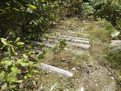
If you try to find these quad trails don't be surprised if they've washed out or grown over. Mother Nature reclaims her territory at a very rapid rate. Trails remain open only through ongoing trail maintenance by groups such as the Wednesday Crew of quad riders and the BOMB (Bloody Old Men's Brigade) Squad group of hikers and ATV owners. Thank you to all of the individuals and groups who maintain our backcountry trails. Through your efforts we all can explore the best that Powell River has to offer.

Want to know more about quad riding in the Powell River Region? Check out these resources.
ATV Category on the Powell River Books Blog
Powell River ATV Club Contacts
Powell River ATV Club Video
Every Trail online 
Up the Main in print or e-book
Farther Up the Main in print or e-book
Beyond the Main in print or e-book
 Do you have any trails to share? Let us know. -- Margy

July 19, 2016

Riding the Rock (Texada Island, BC)


Leaving Powell River on the North Island Princess
Not far from Powell River is Texada Island. It's formed on a volcanic rock and limestone bed that was ground down during the ice age. With many visible outcroppings, it's nickname is The Rock. Texada is 50 kilometres long, and has many forest service and logging roads. That makes it perfect for exploring by ATV.

We left Powell River on the BC Ferries North Island Princess. She runs multiple times daily. Crossing takes about 35 minutes and it's a beautiful ride with views up and down the Straight of Georgia, Vancouver Island and occasional porpoise and whale sightings.


Camping in an old gravel pit reclaimed by millions of daisies.

The population and several active quarries cluster on the northern half of the island. The southern end is open land that has been logged periodically. That's where we headed. On the way through Gillies Bay, we stopped at the Ravenous Raven Lodge and Restaurant for dinner. It was an excellent way to start off a weekend getaway.

Riding a forest service road on Texada Island.

At the end of paved Shelter Bay Road we turned right onto dirt surfaced Bell Road. Main dirt roads are in good shape with occasional potholes. Standard vehicles would have no trouble, but farther south 4X4 is necessary. Many of the spur roads require an ATV, off-road bike, horse, or human foot power.

Signs point the way to Anderson Bay.
At the junction of the forest service road we wanted there was a sign leading the way to Anderson Bay at the south end of the road. There's an old gravel pit past Second Lake, other wide spots along the road, or the recreation site at Bob's Lake remote no service camping.

With full tummies, we set up camp and relaxed as the sun set behind the tall pines and firs. The next morning we offloaded our bikes and set out to explore.


Beautiful ponds and lakes abound.

A map from Powell River Tourism gave us the big picture. We continued south on the forest service road towards Anderson Bay.  Until the final decent, it was fairly wide and rolling. I made it about half way down before I slowed my quad to a crawl. Wayne is a more advanced rider so he pressed on ahead.

Wayne on an old logging road overgrown with millions of daisies.

We worked our way back to Bob's Lake for a lunch break at a picnic table. No one was camping on such a nice summer weekend. In fact, over the 24-hour period we were camping and riding we only saw four vehicles and no other quad riders.

Bob's Lake forest remote recreation site.

There are two main forest service branch roads heading south, Bell Road and Thompson Road. In between there are many old logging roads and a gas pipeline service route available to explore. We used the pipeline route just south of our campsite and joined a logging road that took us through some older growth trees to the east side of the mid-island ridge with ocean views across the Strait of Georgia to Vancouver Island.

Riding a section of the pipeline maintenance road.

We connected with Thompson Road, headed south and reconnected with Bell Road. With impending showers cutting our camping short, we loaded our bikes, packed up and headed back to the ferry terminal at Blubber Bay. Named for its whaling history, it's now home to an Ash Grove Cement Company transfer site.

Historic concrete manufacture site at Blubber Bay.

After putting our quads away, we headed to the Costal del Sol in Powell River for some upscale Mexican food while the thunderstorms gathered and the rain began.

Here are some links for more information about Texada:

Texada Arts, Culture and Tourism Society
Texada Island Wikipedia
Texada Island Geology
Texada Island Maps
Texada Island Recreation Sites and Trails
Texada Island Events
Texada Island Accommodations
Ravenous Raven Lodge and Restaurant
BC Ferries

I invite you to visit Texada Island, whether or not you come to ride The Rock. It has beaches, forests and anchorages galore. It's a place for quiet reflection, or active enjoyment -- something for everyone. -- Margy

May 31, 2016

A Trip to the Head of Powell Lake


Wayne and I took our first barge and quad overnight camping trip of the season to the Head of Powell Lake. We wanted to catch the waterfalls during spring runoff. Because of our early spring they weren't running full bore, but they were still spectacular.


We left from our cabin home at Hole in the Wall just past First Narrows. Thanks to Harry Zroback, Powell Lake float cabins were just featured in Cottage Life magazine's May issue.


Calm water reflected snowy peaks of the Coast Range past Second Narrows. There's pointy Beartooth on the right. Have you ever eaten Beartooth Pie at the Shinglemill Pub? It was invented by Max Pagani, a local realtor and Powell Lake neighbour of ours.


We stopped at several waterfalls to try our luck at fishing. None here, but it's one of many beautiful spots.


We arrived late on Friday after the crews were gone. Before going, we stopped at the Western Forest Products office in Powell River to check on weekend logging activity. Knowing there would be no log trucks hauling, we offloaded our quads and set up camp on the empty barge.


The next morning we rode up Daniels Main to see the spectacular waterfalls fanning out over the granite cliffs. Active logging roads are well maintained. Older ones narrow to rougher trails.


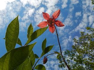
We found colourful spring flowers like this Red Columbine.


Next we went up Powell Main. Both roads are named for the two rivers that feed into the head of Powell Lake. Here's the Powell River before it merges with the Daniels River.


From a lookout, you can see the headwaters of Powell Lake.


We saw four black bears during our ride, but they were too quick to photograph. They are out of their winter dens eating grass while they wait for the berries to ripen.


Thanks for coming along on this quad ride at the head of Powell Lake. We live in an amazing place where you can see and experience amazing backcountry.

You can read more about Powell Lake and regional adventures in my husband Wayne's Coastal BC Stories series of books. They are available locally at Coles or online in print and e-book formats through Amazon, Kobo, and other retailers. -- Margy

March 11, 2016

Riding to the Snow Up Heather Main


Chippewa Bay barge ramp.
Down at the cabin we haven't had much snow this year. But up in the high country, we are finally getting a good snow pack.

Our good friend John tried to ride his quad over Heather Main from the Theodosia side in late February and couldn't make it over the top.

He asked if we would try from the Powell Lake side and we were happy to do so.


We've been talking about riding up to the snow, and this got us going. It also gave us a chance to find good spots for snowshoeing in the future.

Our quads are always loaded on the barge and ready to go. That had made riding from our float cabin home a lot easier.

We motored across to Chippewa Bay and offloaded at the Western Forest Products barge ramp.


From this starting point we rode up the main Chippewa logging road towards Heather Main.

The beginning follows Powell Lake heading north then switches back south and up to a ridge.

This is where we first encountered light snow. It got deeper and harder to navigate before we reached the junction with Heather Main.


Now we have a report for John about the snow level.


And the ride did have a side benefit, an impromptu snow cone with some pop we brought with our lunch.


Read more about winter in Powell River's backcountry in Up the Winter Trail. -- Margy